


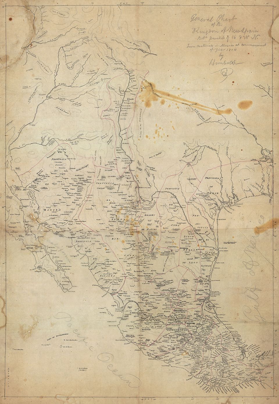
Copy after Alexander von Humboldt, General Chart of the Kingdom of New Spain between Parallels of 16 & 38° N., from Materials in Mexico at the Commencement of year of 1804, 1804, pencil and ink on tracing paper, 37 3/4 x 26 in., Library of Congress, Geography and Map Division.
About this Artwork
This is a copy of the map of North America Humboldt shared with Jefferson. Secretary of the Treasury Albert Gallatin marveled that it contained more and better information than was available on any known map of the continent. In addition to mountains and rivers, Humboldt included territorial boundaries, major towns, churches, and silver mines. Jefferson queried Humboldt about the people and the industries populating the land newly acquired from France as part of the Louisiana Purchase. The Prussian traveler also provided Jefferson with the results of his research, including population statistics. Humboldt’s generosity set the tone for his positive relationships with American statesmen for the next fifty years. Humboldt published his version of this map in 1811.